What can I learn about Malisan Tumuli?
The National Heritage Portal identifies Malisan Tumuli as a designated historic site in Haman covering 797,282.5 m² across multiple land parcels. This entry concerns the tumuli area, not Haman Museum.
함안 말이산 고분군
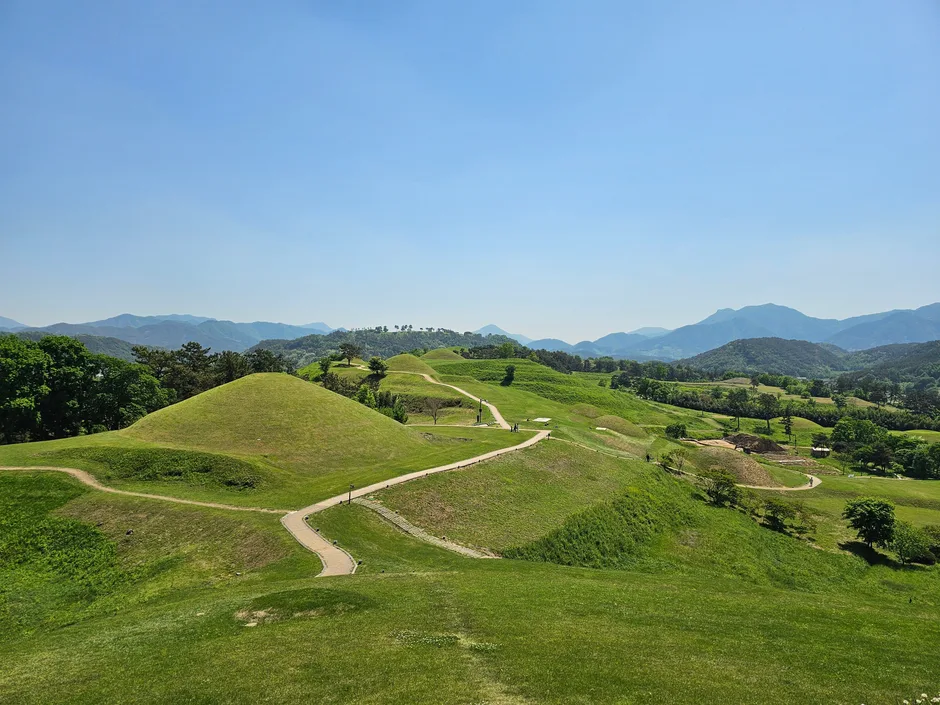
Photo by NZ 토끼들, “2024년 5월 3일 함안 말이산 고분군,” Wikimedia Commons, CC BY-SA 4.0. The image was resized without changing its aspect ratio and converted to WebP. This site's converted version is also offered under CC BY-SA 4.0. See the source link for the original and license. The photo records conditions at the time it was taken and does not establish the site's current condition.
The National Heritage Portal identifies Malisan Tumuli in Haman as a designated historic site covering 797,282.5 m². Its official location is described as including Dohang-ri 484 in Gaya-eup, Haman County, Gyeongsangnam-do, among other land parcels. This is an extensive heritage area, not a single building or visitor facility with one point address.
The source check is more than seven days old. Current visitor and access information is being withheld until it can be checked again. Confirm current conditions with the official source before visiting.
No single verified address or entrance is available. A place-name map search does not confirm the precise location or entrance.
Source publication or modification date: Not available.
Source checked: 2026-10-23. This is when the source material was checked; it is not a site visit or confirmation of current operating or reservation status. Hours, fees, reservations, and travel times have not been verified and are not stated.
Photo by NZ 토끼들, “2024년 5월 3일 함안 말이산 고분군,” Wikimedia Commons, CC BY-SA 4.0. The image was resized without changing its aspect ratio and converted to WebP. This site's converted version is also offered under CC BY-SA 4.0. See the source link for the original and license. The photo records conditions at the time it was taken and does not establish the site's current condition.
The National Heritage Portal identifies Malisan Tumuli as a designated historic site in Haman covering 797,282.5 m² across multiple land parcels. This entry concerns the tumuli area, not Haman Museum.
No single verified address or entrance is available. A place-name map search does not confirm the precise location or entrance.
The source check is more than seven days old. Current visitor and access information is being withheld until it can be checked again. Confirm current conditions with the official source before visiting.
After choosing this stop, check airport transfers and intercity transport, then find your stay or next place.
The source record confirms the official name, historic-site designation, designated area of 797,282.5 m², and a location stated as including Dohang-ri 484 in Gaya-eup, Haman County. Source publication or modification date: Not available. Source checked: 2026-10-23.